
Welcome to the ESE Map Viewer
This map is for illustrative purposes only and is not adequate for legal boundary determination, regulatory interpretation, or property conveyance. For official information, please consult the appropriate municipal and state agencies. For any questions regarding property lines, a licensed land surveyor should be consulted.
This map is based on a variety of sources. None of the data is being certified to correctness in location or content. Rely on it the right amount and remember what GIS really stands for: Get It Surveyed.

1987 Zoning Map

1985 Temporary Zoning Map

1986 Zoning Map

1969 Zoning Map

1957-1959 Zoning Map
Conservation Bylaws and Regulations:
Chapter 37 Bylaw, 1997 or 2000 Attorney General Approval 1997

Town of Chatham Building Height Analysis

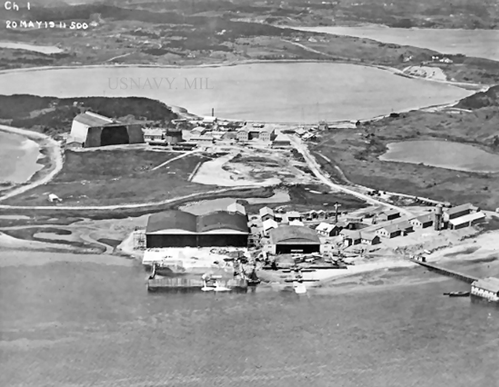
Naval air station

Chatham Naval Air Station & Eastward Point

Town of Chatham Villages GIS

The Causeway 1957 Imagery


North Beach
